
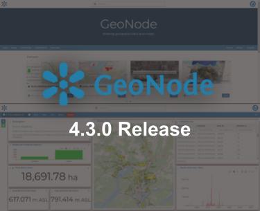
GeoNode 4.3 release
Dear Reader,
We are pleased to announce the new stable release 4.3.0 of GeoNode, and version 4.2.5, the latest version of the 4.2. series. This release includes a list of brand-new features along with security patches and improvements to the existing tools.
The main new features that will be detailed below include:
- Map Viewers
- 3D and catalog plugins for maps
- Catalog resources visibility
- Resource pages
Other improvements that have been implemented:
- An extended User API for the full management of user accounts, including bulk transfer of resource ownership and group manager role.
- Improved the efficiency and robustness of the Backup and Restore routines. Many edge cases have also been covered, with extensive testing in real deployments
- The addition of the Groups filter (facet) to the filters panel
- Fixes and improvements to exiting functionality, including the upload of XML and SLD files.
The GeoNode stack of services has also received important upgrades:
- Django 4 (Django 3 reached its EOL in March this year)
- Geoserver 2.24.3
- MapStore 2024.01.00
- PostgreSQL 12 is the minimum supported version
Map Viewers
The GeoNode client has made a big leap forward thanks to the upgrade of the MapStore version, and the alignment to its latest features. This work has paved the road to the integrations of MapStore Application Context in GeoNode under the “Map Viewer” name. With a Map Viewer the list of map tools and plugins available in a map can be configured, including all the MapStore plugins that weren’t available in GeoNode until now.
Map Viewers can be created from a map (the feature is available under the Edit menu) and they can be used by multiple maps. This permits to exclude from the map tools that have been always available by default in a GeoNode map (e.g. the Table of Contents, the Background selector, etc.) or include tools that are not available by default. The maps with a connected Map Viewer will always show up according to the configuration of the Map Viewer, including when embedded externally.
3D and Catalog plugins for maps
The work done to extend the integration with MapStore has brought new plugins powered by MapStore. Two of these plugins have been enabled by default for maps: 3D view, powered by Cesium, and the Catalog tool which gives users the option to include external layers (from WMS, TMS, CSW, etc. services) directly into a map. This option doesn’t replace GeoNode Remote Services, because the latter permits the publishing of external layers as GeoNode resources and can take advantage of the Harvesting engine capabilities. On the other side the MapStore plugin can only include layers within single maps, but it offers extended support on the types of remote resources that can be included.
The 3D view is the first step toward the publishing of 3D content with GeoNode. Meanwhile, external 3D Tiles sources can already be viewed inside a GeoNode map thanks to the Catalog service for 3D Tiles.

GeoNode 3d View
Catalog resource visibility
There are cases where a resource is created only to be used within other resources. Examples are images uploaded to be included in a geostory, or datasets only meant to be published inside maps,. It could be that we don’t want these resources to be listed inside the catalog, or search results, also to avoid cluttering the catalog list. For these cases, a new “Advertized” attribute is available under the Settings tab of the Metadata editor. When this flag is turned off the resource will only be listed to the administrators and its owner. This doesn’t affect the permissions on the resource. Users with view permissions can still visualize the resource, but it won’t be listed in the catalog for them.
When a resource is not advertised a yellow crossed-out “eye” icon will be visible inside the resource cars and the details panel.
Resource pages
The navigation of resources has received some improvements. The menu buttons for the resource types navigate to catalog views with dedicated tools for each resource type. Each view contains:
- The “New” button lets users create or upload the type of resource for the specific view (e.g. it will let users create a new Map when viewing the Maps catalog)
- The filter panel will only show filters for the type of resources in the view (e.g. filters for datasets won’t be visible inside the Maps catalog view)
Beyond the effects on the UI and the UX, this change lets developers configure the default catalog view when the users navigate the root of the catalog and apply specific configurations (action buttons, filters, etc.) for the specific catalog view.
The full list of changes and bug fixes can be found in the changelog.
If you are interested in learning about how we can help you achieve your goals with open source products like GeoServer, Mapstore and, GeoNode make sure to talk to us!
The GeoSolutions team
