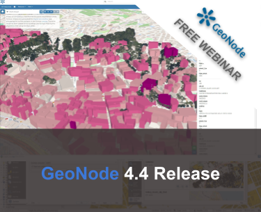
FREE Webinar: GeoNode 4.4 Release

Dear Reader,
Join us on January 30th 2025 at 11am Eastern US / 5pm Central Europe, for the next free webinar as part of the GeoSolutions instructional webinar series on open-source software products, including GeoServer, GeoNode, and MapStore. On January 30th we will be featuring the latest Release of GeoNode, Release 4.4. In the next sections we are going to describe some of the most important features that are part of this release. Meanwhile you can register here below for free!
3D Tiles Resources
3D Tiles visualization was introduced with the previous version of GeoNode, thanks to the updated MapStore framework which powers its client application. However, this capability was limited to single maps, where remote 3D tile assets could be added through the client catalog plugin. With this new version 3D Tiles become first-citizen resources in GeoNode, along with 2D vector datasets, raster files, and documents. 3D Tiles can be published as catalog resources, both from local and remotely served assets, receiving support for all the standard GeoNode functionality such as searching, filtering, sharing, permissions and access management, metadata, linking, etc.
The following video shows both options. In the first part a 3D Tile is created from a remote URL, then an example from a local zip file containing a valid tileset is presented. For both cases, GeoNode expects to obtain a tileset.json file at the root of the URL or find it inside the root folder of the zip file, from where all the needed information to process the tileset (spatial extent, tiles structure, etc.) are retrieved.
Assets
With this version, a new concept has been introduced in GeoNode, Assets. This model has been introduced to extend and improve the relationship between resources and files that exist behind them. Support for 3D Tiles and resource attachments is a primary motivation for this update.
Files, resulting from the upload of documents and datasets, were semi-hidden behind the scenes and weren’t exposed to the internal GeoNode APIs. Assets introduce a model that makes the management of files explicit and decoupled from resources. For the moment this isn’t visible to end users. In the future, there might be an asset management area where files can be uploaded and managed independently from catalog resources. Eventually, a resource can be created from an existing asset at a later stage. This is what GeoNode does now: When a new resource is uploaded, GeoNode creates an asset for the file(s) and then creates a resource connected to these asset(s) through the Link model.
As mentioned previously, Assets were also implemented to introduce the option to attach multiple files to a single resource. This is already achieved by manually creating an asset and then connecting it to a resource through a link; however, this is only doable from the Django admin interface, which is restricted to GeoNode administrators.
Notice that the uploaded files now are stored at the path configured by the new ASSETS_FOLDER settings. When upgrading from a previous version of GeoNode a dedicated command must be executed to migrate files to this new structure.
QGIS GeoNode Plugin v2.0
We are also happy to announce that a new version of the GeoNode plugin for QGIS has been released! The plugin allows users to search, filter, and load resources from a GeoNode catalog from QGIS. It supports authenticated access to the resources through WMS, WFS and WCS, leveraging the GeoNode REST API. Authenticated users can edit the style and data (for vector datasets only) of resources and upload new datasets to GeoNode. Basic metadata information can also be edited directly from QGIS.

QGIS GeoNode Plugin
Version 2.0 fixes a list of long-standing issues and blockers, and it introduces several enhancements to the UX and more robust error handling. Support for legacy GeoNode APIs (GeoNode versions 4.0 and prior) has been dropped.
Registration information
To learn more about how to create a downstream product using MapStore, I cordially invite you to a free webinar on January 30th 2025 at 11am Eastern US / 5pm Central Europe by registering through the link below!
Looking forward to seeing you on the webinar!
If you are interested in learning more about how we can help you develop a WebGIS using MapStore or help you achieve your needs with MapStore, GeoServer, GeoNode and GeoNetwork through our Enterprise Support Services, Professional Training Services and Subscription Services please contact us!
The GeoSolutions team,


