
FREE Webinar: Supporting Mobility and Infrastructure Decisions in Flanders with MapStore
Dear Reader,
Join us on Tuesday March 25th 2025 at 3PM Central Europe, for the next free webinar as part of the GeoSolutions instructional webinar series on open-source software products, including GeoServer, GeoNode, and MapStore. On March 25th we will be featuring an interesting use case for MapStore. Our Belgian Partner Geo Solutions NV will talk about their experience with GeoServer and MapStore since they are supporting a few customers with solutions based on MapStore and GeoServer. You can register here below for free!
Geo Solutions NV combines, visualizes and integrates location data in a smart and clear way. This is how they arrive at insightful data for our clients within every industry. From total solutions to consulting and maintenance, they offer customized solutions for every geo situation.
Geo Solutions NV will talk about the MapStore project they support and manage for one of their main customers: Department Mobility and Public Works (DMOW). What started as a proof of concept a few years ago has quickly grown into the solid open-source web-GIS portal of DMOW using MapStore, GeoServer, GeoNetwork and PostgreSQL.

Vlaanderen Department of Public Works MapStore Homepage
DMOW is in charge of policy making about the very broad domain of mobility and public works at the level of the Flemish Government. The MapStore portal is used to facilitate decision making in a geo-data enabled way with internal resources. In most cases only using the ‘viewer’ capabilities, but in some cases also to edit the data directly (e.g. for intelligent traffic lights) through MapStore. The governmental outcomes are public, so the outcomes of the process are also made publicly available to the citizens in user-friendly configured MapStore maps, contexts and geostories. Some of them are directly embedded in the official websites of DMOW.

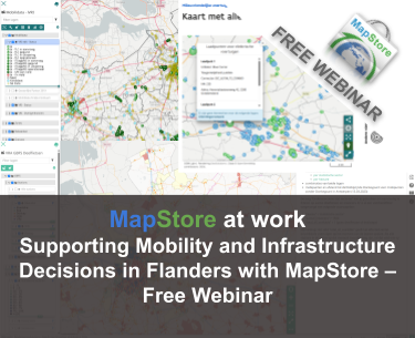
MapStore map to disseminate mobility data.
By leveraging our support contract, DMOW also managed to extend the flexible software with custom plugins like the PhotoViewer and integrations of the custom OpenID authentication and authorization system of the Flemish Government.

Photoviewer application for DMOW
During the webinar we will show the broad implementation of different MapStore functionalities by highlighting a couple of interesting real-world use cases like intelligent traffic lights, public charging stations and bicycle infrastructure conditions.

GeoStory at work for DMOW
It is also interesting to report on the fact that at the moment intelligente traffic lights are managed directly in MapStore via GeoServer WFS transactions.

Intelligent traffic lights managment in MapStore
Registration information
To learn more about how to create a downstream product using MapStore, I cordially invite you to a free webinar on Tueday March 25th 2025 at 3PM Central Europe by registering at the link below!
Looking forward to seeing you on the webinar!
If you are interested in learning more about how we can help you develop a WebGIS using MapStore or help you achieve your needs with MapStore, GeoServer, GeoNode and GeoNetwork through our Enterprise Support Services, Professional Training Services and Subscription Services please contact us!
The GeoSolutions team,
